
SOLUTIONS FOR
THE COMPANY
RESOURCES TO IMPROVE AGRICULTURAL INSURANCE MANAGEMENT
The historical and current crops online information consult, an accident real causes research or geographically manage the acquisition of insurance policies are just a few benefits of our proposal to the insurance department.
Explore our modules and find the solution you need.
01. WebGis
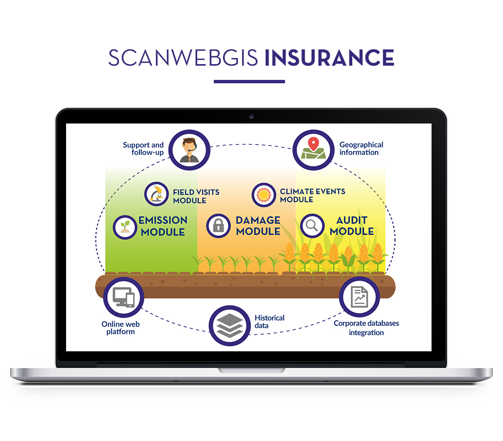
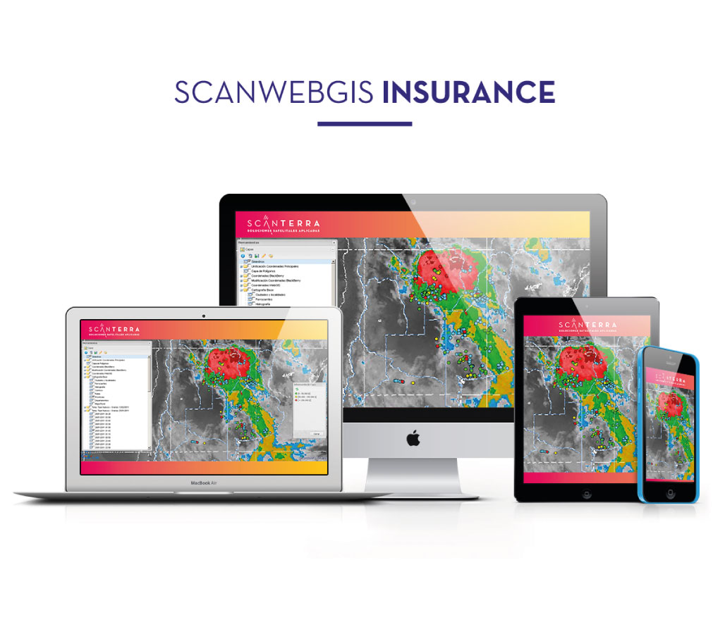
SCANWEBGIS
ScanWebGIS system, which automatically incorporates to your company corporate basis, allows to geographically manage information related to subscriptions, accidents and field appraisal. As a result you will be able to improve your business managing, control funds, evaluate the producers network, among others.
More Info
- Access via internet to our system using your username and password.
- Cloud services available around the clock.
- Web and mobile App available in Smartphones, tablets and PCs.
- Continuous improvements and updates.
- Help desk.
- Customized support and follow-up.
- Training.
- High value access to the geographic database.
- Initial import of the geo-referenced information.
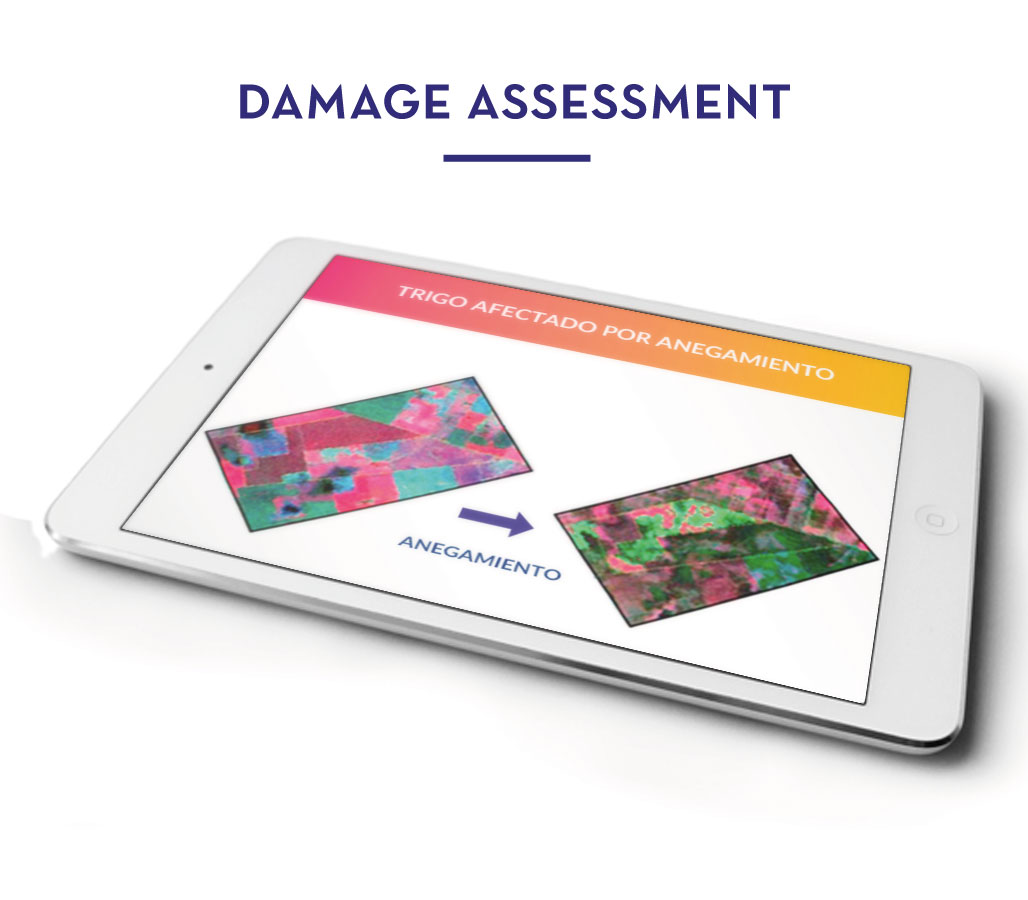
02. Damage Assessment
More Info
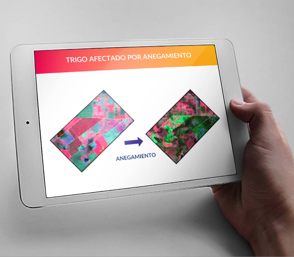
The studies, information and results are available in a web and mobile platflorm to facilitate their use and interpretation.
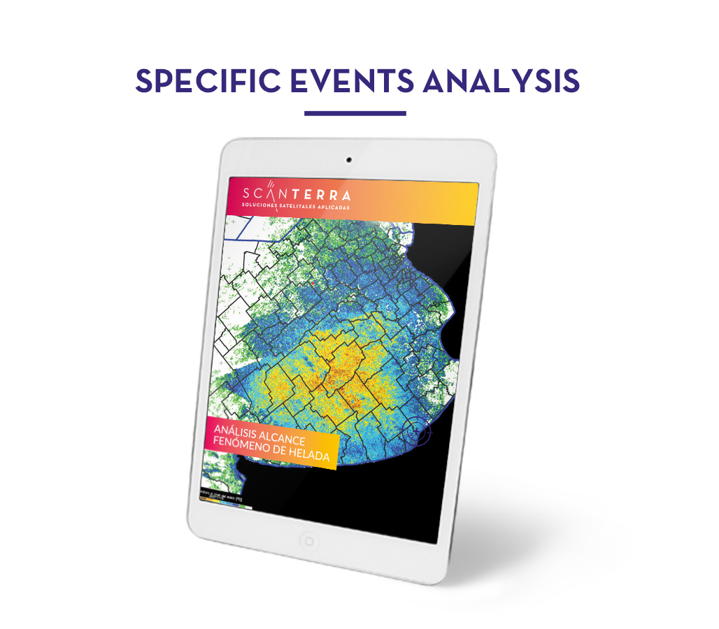
03. Events Analysis
More Info
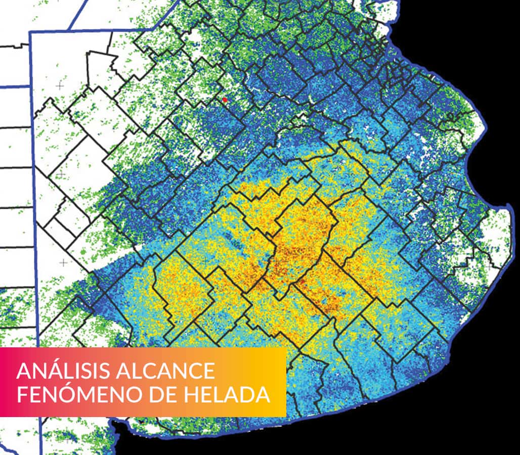
The studies, information and results are available in a web and mobile platflorm to facilitate their use and interpretation.
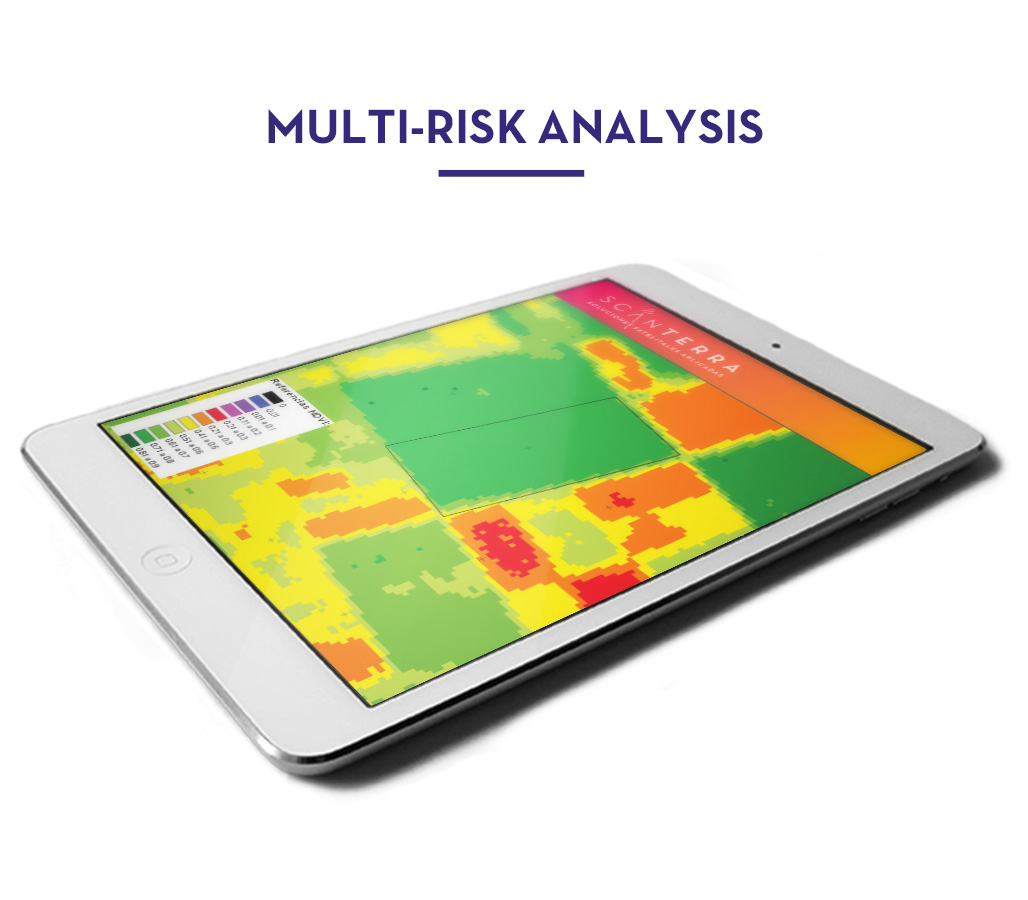
04. Multi-Risk
More Info
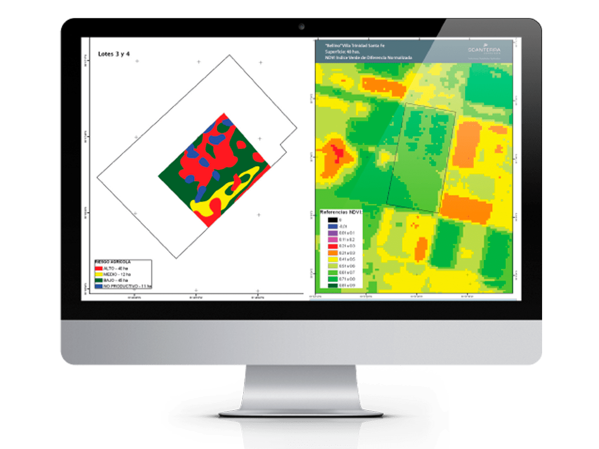
The study, based on satellite information accrued over 20 years of investigation, allows to know your fields risk regarding the soils quality, relief, waterlogging frequency and drought.