
SOLUTIONS FOR
AGRICULTURIST PRODUCERS
Would you like to obtain a thorough understanding of your field?
OUR STUDIES WILL ENABLE YOU TO FACTUALLY KNOW YOUR FIELD TO PICK THE RIGHT PATH
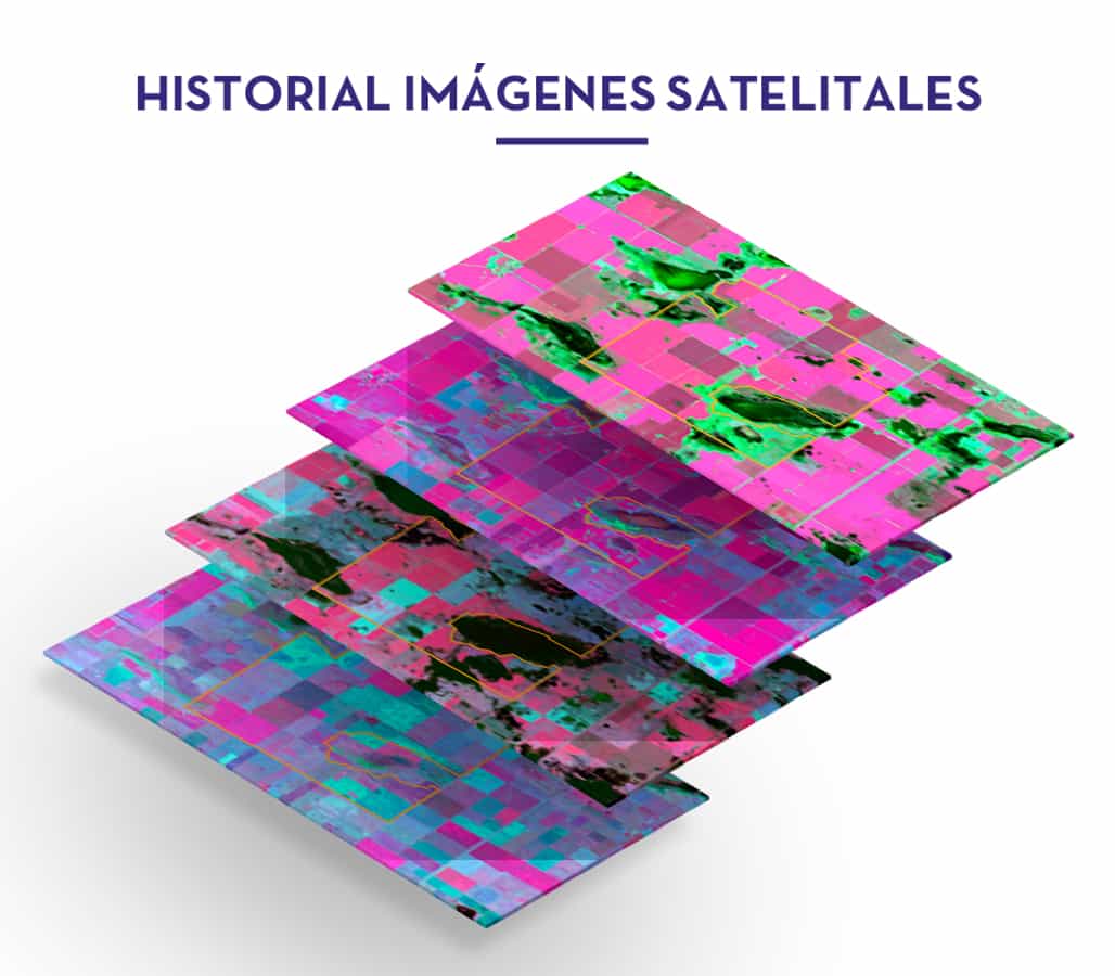
Each field and environment is different, therefore, each of them requires customized production schedule to maximize their profitability. ScanSurvey will allow you to have a deeply knowledge of your fields each section by means of objective measurements. Our service includes performance history, critical areas reports and every critical aspects to accurately appraise your fields value.
DESCRIPTIVE EXPLANATORY REPORTS IN DIGITAL AND PRINTED VERSION DEVELOPED BY THE USE OF MAPS AND SATELLITE IMAGES
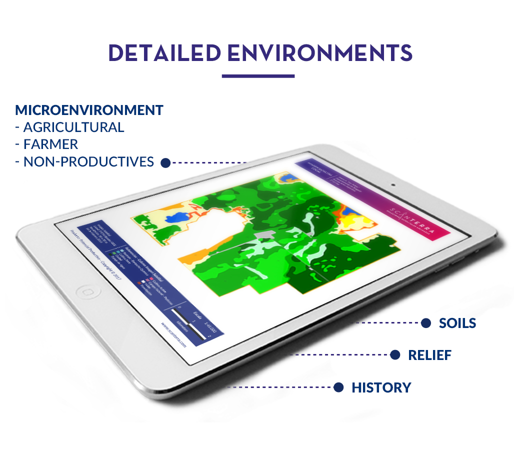
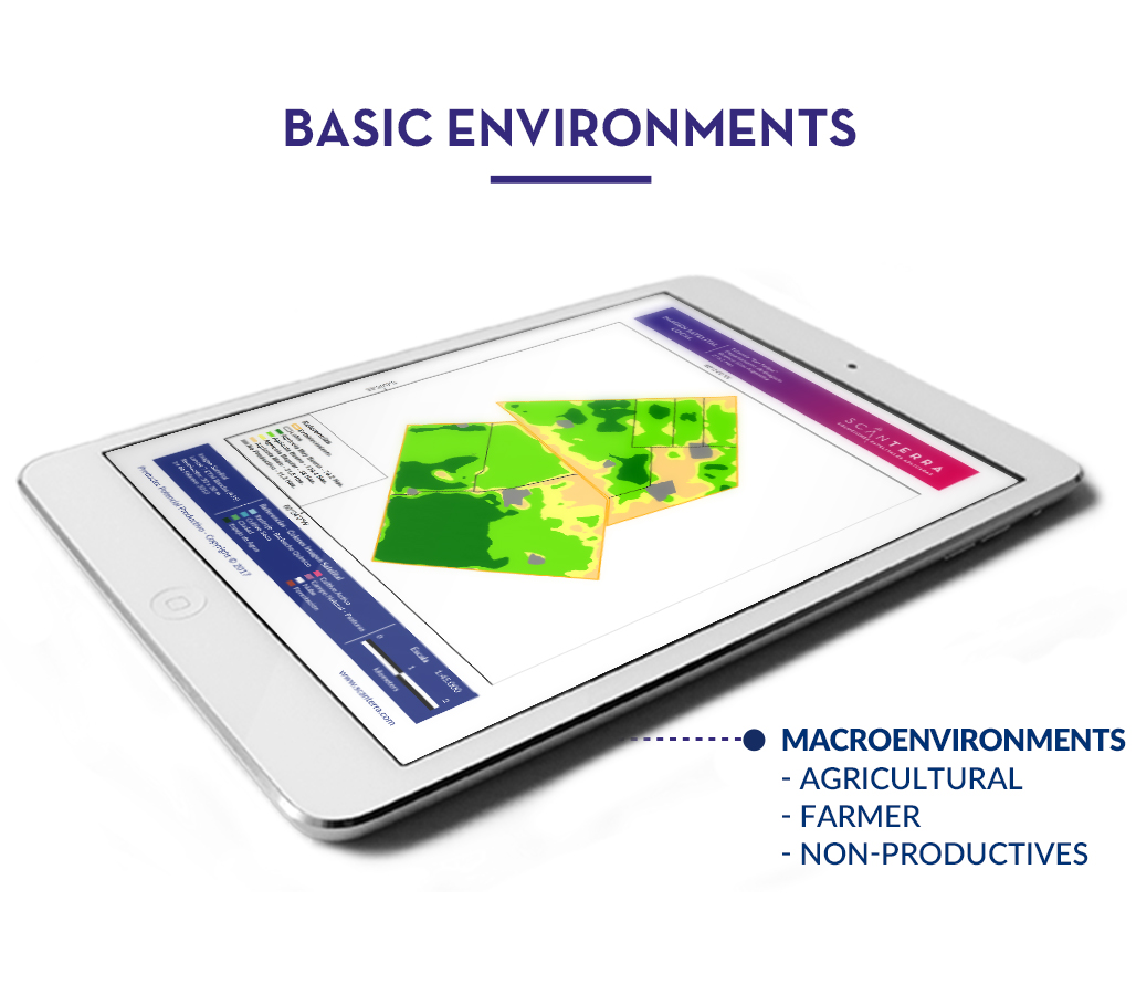
DETAILED ENVIRONMENTS
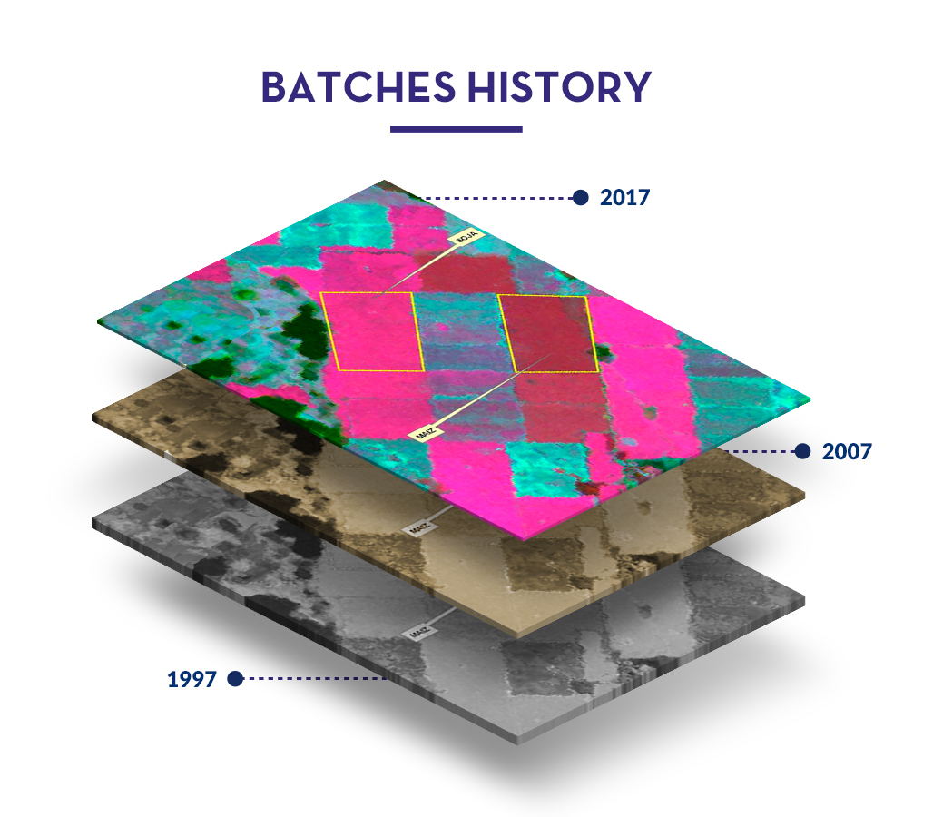
It’s possible for you to determine your field’s productive potential, quality and risks and make the difference between agricultural, farmer and non-productive environment. Our studies, based on satellite information accrued over 20 years of investigation, will enable you to factual know your field and conduct more extensive managements such as subdivision, appraisals, project planning, among others.
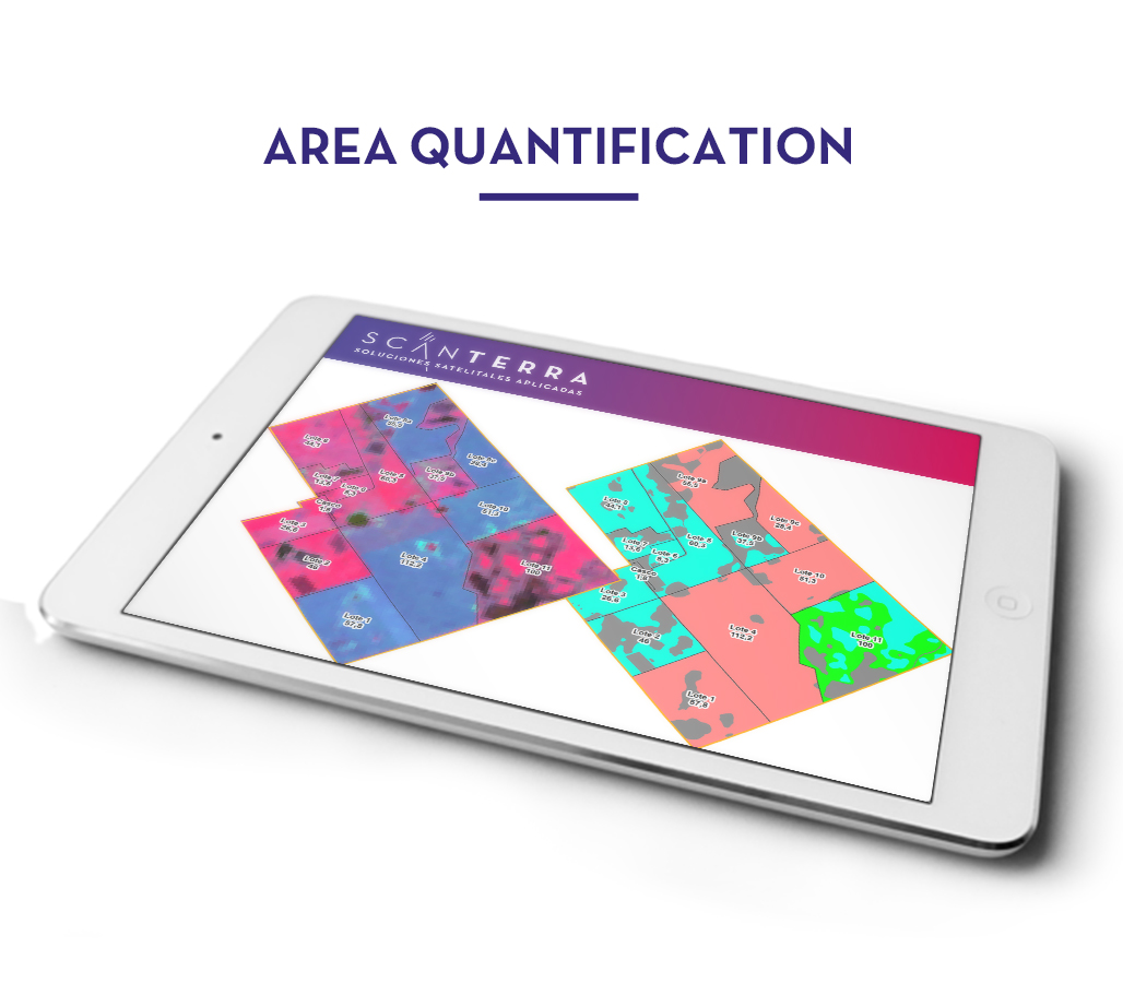
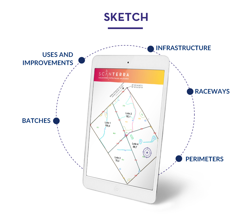
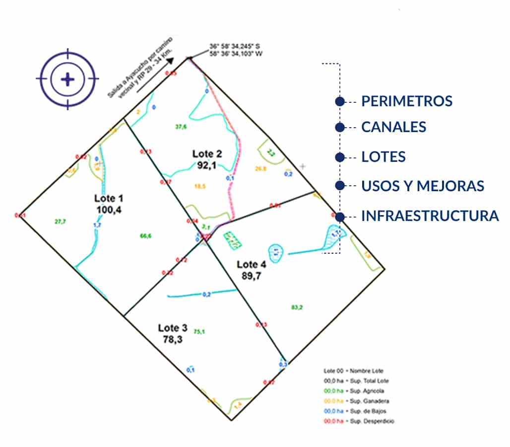
The studies, information and results are available in a web and mobile platflorm to facilitate their use and interpretation.

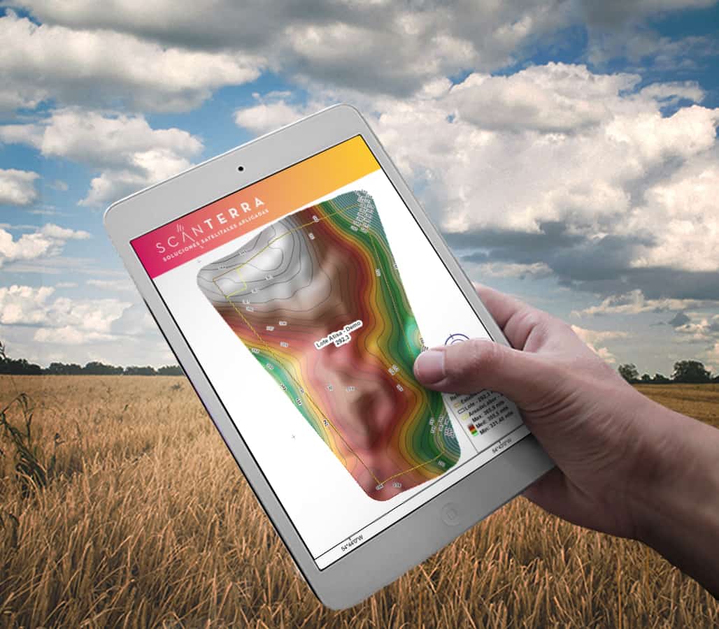
The studies, information and results are available in a web and mobile platflorm to facilitate their use and interpretation.
The studies, information and results are available in a web and mobile platflorm to facilitate their use and interpretation.